Iceland possesses a raw and rugged beauty unlike anywhere else on Earth. In this Nordic island nation, geothermal and tectonic processes combine with often wild weather to dramatically shape the landscape. Visitors can travel almost as far north as the Arctic Circle to see glaciers that hide subterranean volcanoes and glittering ice caves, waterfalls tucked away at the end of remote valleys, and beautiful, unspoiled beaches backed by cliffs teeming with birds. Wondering where to start? Here are the seven most breathtaking natural landmarks in Iceland, the so-called “Land of Fire and Ice.”
Svartifoss (Black Falls)
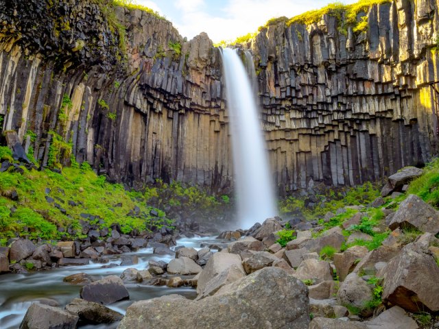
Waterfalls are abundant in Iceland, but a handful of them stand out for their remarkable geology. One of the most striking is Svartifoss, flanked by charcoal gray basalt columns that were created from a lava flow 300,000 years ago. Located in the heart of the Skaftafell nature reserve, it forms part of Vatnajökull National Park.
To reach Svartifoss, you’ll need to follow a mile-long hiking trail that slowly climbs up from the visitor center. Standing less than 66 feet high, Svartifoss doesn’t come close to being Iceland’s tallest waterfall — that honor goes to Morsárfoss, which is more than 10 times the size. Yet, Svartifoss is a tourist favorite. In summer, lush vegetation springs up at the water’s edge, while in winter, under a dusting of snow, it’s one of the most exquisite sights in the country.
Jökulsárlón Glacier Lagoon
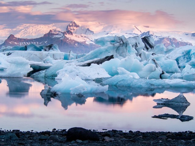
Jökulsárlón is one of the jewels of Iceland’s popular south coast. The glacier lagoon sits in the shadow of Breiðamerkurjökull, an outlet glacier of the much larger Vatnajökull glacier. As Breiðamerkurjökullr travels downhill under the effect of gravity, chunks of ice calve into the saltwater lagoon of Jökulsárlón.
Zodiacs ferry passengers to the glacier’s mouth and weave in and out of the bobbing hunks of ice. Often, you’ll see seals sprawled out on the larger icebergs or swimming leisurely in the chilly water. Walk along the shoreline towards the ocean, and you’ll soon reach Fellsfjara, better known by its “Diamond Beach” nicknames. Here, the waves interact with the icebergs that have drifted out to sea, washing them back onto land and eroding them until they melt into the black sand.
Strokkur
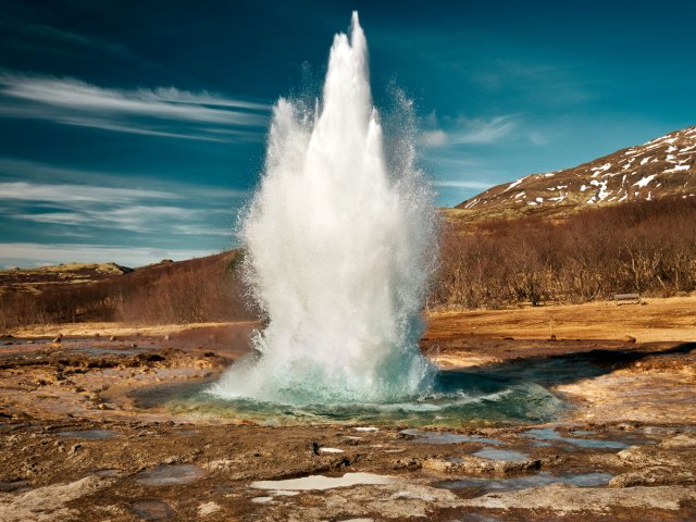
Strokkur, Iceland’s most active geyser, is the reason most people come to the Haukadalur valley. Also referred to as the Geysir Geothermal Area, it’s a highlight of Iceland’s famous Golden Circle route. This is where you’ll find the original Geysir, now inactive, and a wealth of other steaming fissures, mud pots, and mineral speckled grounds.
But all eyes turn to Strokkur: This landmark is a reliable performer, putting on a show about every six to 10 minutes. The first sign of action comes as the turquoise pool begins to shiver and then dome. As the surface of the water fractures, the geyser shoots a plume of superheated water and steam into the air, typically between 30 and 60 feet high.
Studlagil Canyon
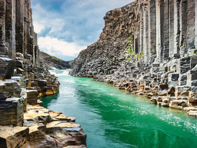
Until 2009, Studlagil’s natural beauty was hidden underwater. Then, a dam was constructed upstream as part of the Kárahnjúkavirkjun hydroelectric power project. As a result, the level of the Jökulsá á Dal River fell, and the stunning canyon was revealed. Studlagil has rapidly become one of East Iceland’s must-see attractions thanks to its remarkable concentration of rust-covered basalt columns. If you visit in early summer, the water should be a dazzling blue-green. But even when glacial water, heavy rainfall, or snow melt turns it a dull gray, the canyon’s still an impressive sight.
Reynisfjara
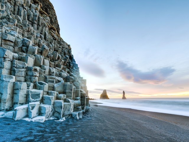
Reynisfjara is a breathtaking beach located near the village of Vik on Iceland’s south coast. A broad strip of black sand lines the shore, and behind it sits Hálsanefshellir, a sizable cave cut by the waves. The cave’s walls are formed from basalt columns and cooled pillow lava. Flanking the cave is an 1,115-foot-tall tuff cliff, the ocean-fronting face of Reynisfjall mountain. Throughout the summer breeding season, puffins make their nests on its grassy ledges.
Just offshore, the skinny, gnarled sea stacks of Reynisdrangar bear the scars of constant wave erosion. But it’s the waves themselves that make this place infamous — they often arrive unannounced and sweep back to the sea with great force.
Landmannalaugar
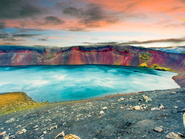
The Landmannalaugar area is often considered the highlight of Iceland’s Highlands. Accessible by road only for a short period of time in summer, Landmannalaugar forms part of the Fjallabak Nature Reserve, occupying a space on the edge of the Laugahraun lava field backed by hills. These rhyolite peaks are streaked with red, blue, yellow and green, making this one of the most colorful areas in the country.
Locals often call this place “the People’s Pools” because the area is geothermally active. Once, this would have been a stop for weary travelers and farmers moving livestock between grazing lands, but today it’s a tourism hub. One of the most popular activities after a day of hiking in Landmannalaugar is to follow the wooden boardwalks to its naturally heated warm water pools for a restorative soak.
Crystal Cave
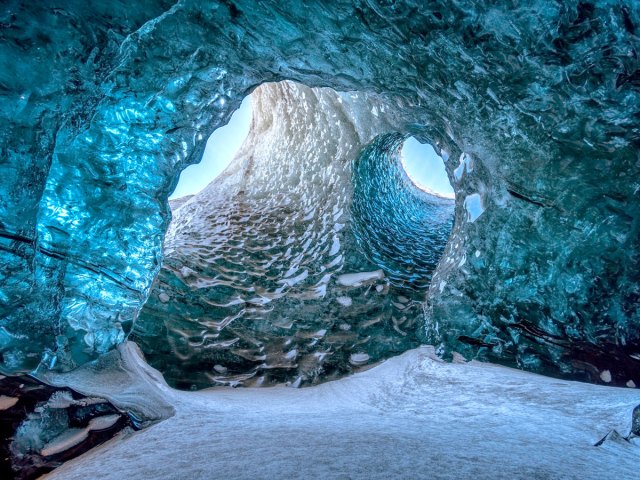
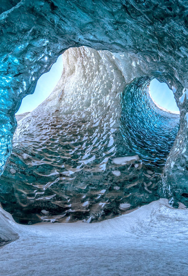
With the arrival of spring in Iceland, rising temperatures create meltwater streams in glaciers such as Vatnajökull. This water trickles down through cracks and crevasses in the ice, hollowing out vast caverns that are hidden from sight. Crystal Cave is one such example, and because of the way it’s formed, the precise location of the cave can change from one year to the next.
By late November, the colder weather has stabilized the ice, and it’s considered safe enough for visitors kitted out with helmets, crampons, and ice axes to venture across the glacier with a qualified guide. Inside the cave, an extraordinary scene awaits — the ice cave’s translucent blue ceilings and walls are as if a hugely talented sculptor had been at work, yet no human could match the work of nature.
More from our network
Daily Passport is part of Optimism, which publishes content that uplifts, informs, and inspires.
